If you've got the impression that the only good roads to drive in Southern California are the canyon roads around the Angeles forest near Los Angeles, there's a good reason for that. They are excellent roads, and LA has a huge car culture. But, most influentially, LA is home to many major automotive publications, has the most automotive content creators and journalists, and they have access to the largest press loan car fleets. It makes absolute sense for LA-based content creators and journalists to hit roads like the Angeles Crest Highway for videos and photos. Add to that the events brands put on often come to California in the winter months as the weather is generally still good, and you now know why you know some of those roads - even if you've never been to California.
However, there is much, much more for driving enthusiasts to explore in Southern California. We have many of the best driving roads in the US, and Los Angeles County is just one of ten counties in SoCal. Get out of LA, and you have mountains, valleys, high desert, low desert, and roads that will blow you away with their views while being a pleasure to drive fast or just sit back and cruise on. These are the first four of those roads that we love and, because we take our research seriously, examples of cars we think suit them perfectly.
Palms To Pines Highway
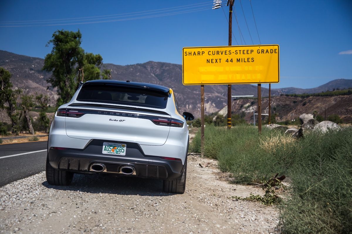
The road connecting the city of Hemet in the Inland Empire to the Palm Springs area is known as the Palms To Springs Highway, one of the most scenic routes in California and bookended by two sections of technically challenging roads to drive at pace. We recommend starting on the Hemet side, mainly because Hemet is an excellent place to leave, and looking out for the sign below on the 74. Once you see that sign, it's game on as you snake up the mountain experiencing tight, but flowing corners, fantastic views, and then a long set of S bends cambered perfectly for carving before you reach Idyllwild Mountain Center and relax for a while and cruise the long straight section through a picturesque valley and past Hemet Lake. Along this section, you can pull off to explore the lake or one of the hiking trails, and if you're in something with some ground clearance, the 14-mile Thomas Mountain Trail takes you even higher and shows off some of California's finest scenic views.
We chose the Cayenne Turbo GT to document the Palms To Pines Highway as it's insanely fast and capable in corners but also a pleasant and roomy ride for the Pines stretch of the road before you start hitting the twisting tarmac again. The second challenging section of the road takes you through eye-catching piles of volcanic rock before you start going back down and toward Palm Springs. The last section features long, sweeping switchbacks that get tighter as the elevation drops and breathtaking views of the city below. It's a two-ish hour drive at the speed limits, but you'll land in Palm Springs, which offers much more than just tennis courts, golf courses, and expensive resorts.
Angeles Crest Highway
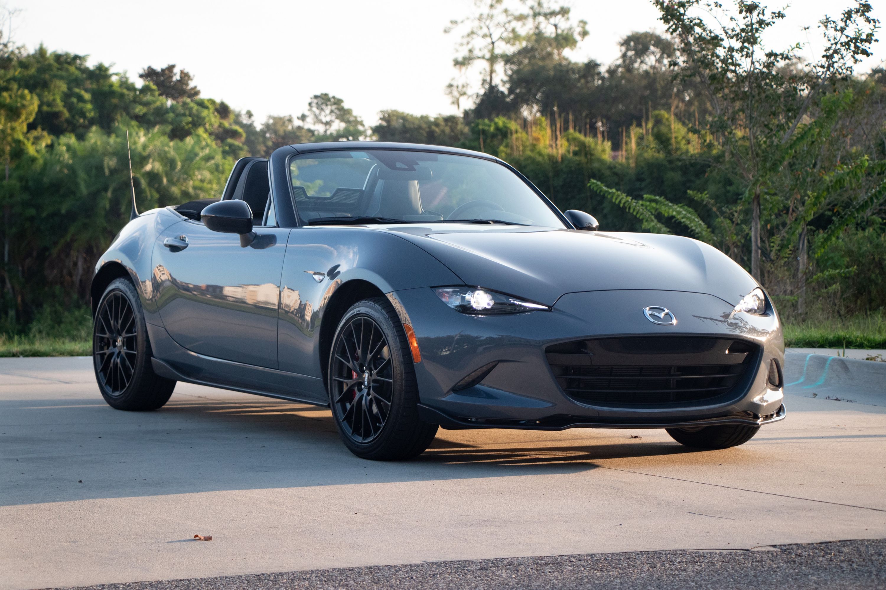
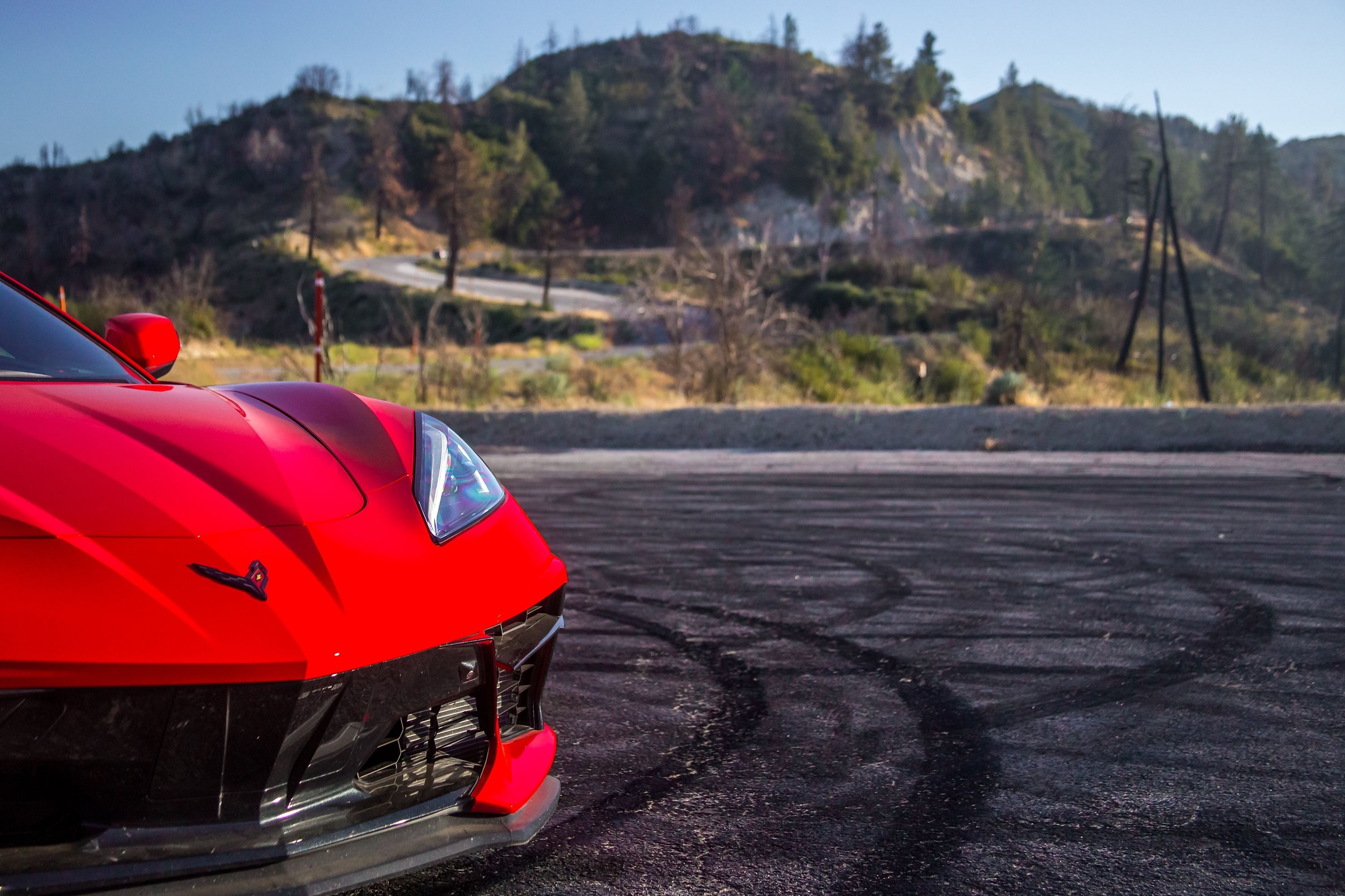
There's a reason people love the Angeles Crest Highway. When we get a car that deserves a run out on the 66-mile route from the pine tree-lined town of Mountain Top to the desert city of La Canada, we make the trip, as we did with the 2019 Mazda Miata. It's a Mecca for car enthusiasts as the road is easily accessible, long, and winding, and it has plenty of big turnouts for taking a break, meeting friends, taking the obligatory car-in-tire-marks photos, and admiring views. It's an easy road to spend a day on, as well, as there are campgrounds, scenic lookouts, and hiking trails to explore. For those reasons as well, we recommend avoiding the road on weekends during the day. If you're into car spotting, Friday mornings are a good time, although you're guaranteed to spot at least a few cool cars at any time.
To reacquaint ourselves with the Angeles Crest Highway, we took a Corvette Stingray with the sport package out there. The mid-engined Corvette is perfectly suited to the bends and turns of the road, but we don't treat it as a racetrack. For going quickly, nighttime is best, but the road is well known to cops and inexperienced drivers trying to race experienced locals, so you've been warned. Ideally, we suggest something quick that can hold the road but is comfortable and you can see well enough out of to take in the view when stuck behind a 1990s Subaru Outback.
Box Canyon Road
About 45 minutes from Palm Springs, next to Joshua Tree State Park, is a little-known road called Box Canyon. The interesting part isn't long, but it's fantastic, and you'll wonder how many westerns have been shot there. The road is mostly smooth, and the speed limit is easily broken. Even at the speed limit, though, there are a few bends to catch out the unwary, and you'll see the tire marks of those that have used their brakes too little too late. It's not a canyon you need to drive through fast, though. We took a Golf R up there for shots, as it's fun to drive at any speed. If you slow down, you can take in the rock formations and marvel at how old and pretty they are.
Box Canyon has a strange history, as it was the home of a doomsday cult from the 1950s to the 1980s called Fountain of the World. The cult believed World War III was imminent and would be fought between communist Russia and capitalist America and coincide with a race war. The prediction was that the godless Russians would prevail and Fountain of the World would step in and save the world with peace and love. The founder was killed violently by two suicide bombers that believed he was a sexual predator and had stolen their wives.
Box Canyon links the CA 111 with I-10 and continues north into Joshua Tree National Park. Technically, if you cross the 10 freeway into Joshua Tree, you're on the same road, and if you haven't been through that state park yet, you won't regret it.
Just remember the speed limit is low through the park. If you're in an off-roader, there's a four-mile-long dirt track off of Box Canyon that takes you into Painted Canyon, which is a spectacular area with rock formations colored with shades of pink, orange, red, and grey.
Mount Baldy Road
Mount Baldy is a mountain in the Ontario area. If you punch Mount Baldy into a navigation app and follow directions, you'll find yourself heading up the mountain. But you'll want to turn left onto Mount Baldy road and take great care as you keep winding up and around. The road is narrow and twisting, and we took the wrong Mazda the first time out. So, we returned in a Mazda MX-5 Miata to explore it again recently. We also revisited the road in heavy fog. Eventually, you'll find a fork in the road, where you can go left and stay on the same kind of road to land in Glendora for food, or you can turn right and follow the wider road on the side of the mountain out into what feels like the middle of nowhere.
It's a spectacular drive but beware of cops if you have a heavy right foot. The Glendora locals know about the road, and you'll see some interesting cars out there at the weekend. Eventually, if you follow the east road, you'll be able to turn left again to head to civilization. Or, you can turn right and head further out in the wild to Mount San Antonio. We ran out of daylight, but we'll return and see what the roads beyond that are like later. In the meantime, if you're in Southern California or get the chance to visit and drive, each of these roads is worth a visit and doesn't need something fast to enjoy. That's just a bonus.


